ARTICLE AD BOX
The pre-summer heatwave will come to an end across South Australia and most of Victoria this weekend, as the trough responsible for bringing in the heat is set to move across the region, bringing cooling showers and a southwesterly wind change.
The relief from this early season heat will certainly be a welcome change for SA on Saturday, with most of the state recording maximum temperatures more than 10 degrees above average on Friday. The biggest departure from average came from Mt Gambier, soaring to 37.7°C, more than 17°C above the November average. Meanwhile Adelaide sweltered at 37.5°C, more than 13°C above average. For both these locations, as well as many more across SA, it was the hottest day since March.

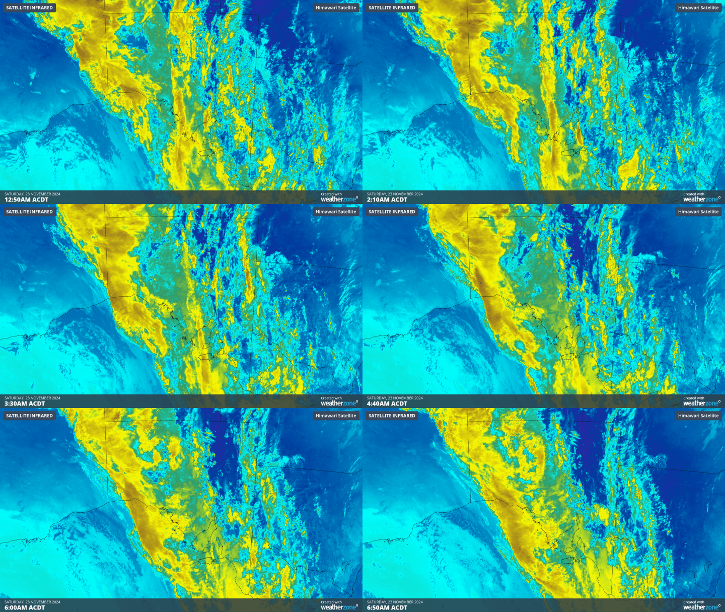
Gif: Infrared satellite image overnight for SA.
The trough has already increased cloud cover across the state overnight ahead of impending showers and the odd storm, however this cloud subjected the state to an uncomfortable night. The minimum temperatures to 7am CDT hovered in the low to mid 20s across central and southern SA, with Adelaide’s overnight minimum staying at 24.6°C.
That’s not to say it won’t cool down further during the day, with showers and isolated storms, accompanied by a southwesterly wind change and a much cooler airmass, set to sweep across southern and central parts of the state on Saturday. Rainfall totals are only expected to reach 15-30mm but will be widespread, allowing daytime relief while putting a slight dampener on weekend plans. Once the southwesterly winds pick up, temperatures will drop back towards the high teens to low twenties, still a warm night, but much easier to sleep through.

Image: Forecast maximum temperatures across Vic on Saturday.
Victorians will need to wait one more day for this relief, as Melbourne is expected to reach 37°C today. Meanwhile most of the remaining parts of Vic will also warm to the mid to high thirties today. Western and central Vic already have a head start, as the cloud cover ahead of the trough kept these areas above 20 degrees for most of the night. Melbourne only managed to drop to 22.7°C and has already warmed up to 29.0°C by 9am.
Rainfall across Vic tomorrow may amount to slightly higher totals than for SA, although 24-hour totals should still stay below 40mm. Just like SA, it will likely be the cooler temperatures that are most welcome from this trough as the pre-summer heatwave reaches its conclusion for the southeast.

Image: Accumulated precipitation to Sunday night for southern and central SA and Vic.


 English (US) ·