ARTICLE AD BOX
Tropical Cyclone Sean has formed as a category 1 system close to Karratha off the Western Australian coast, packing winds of up to 120km/h.
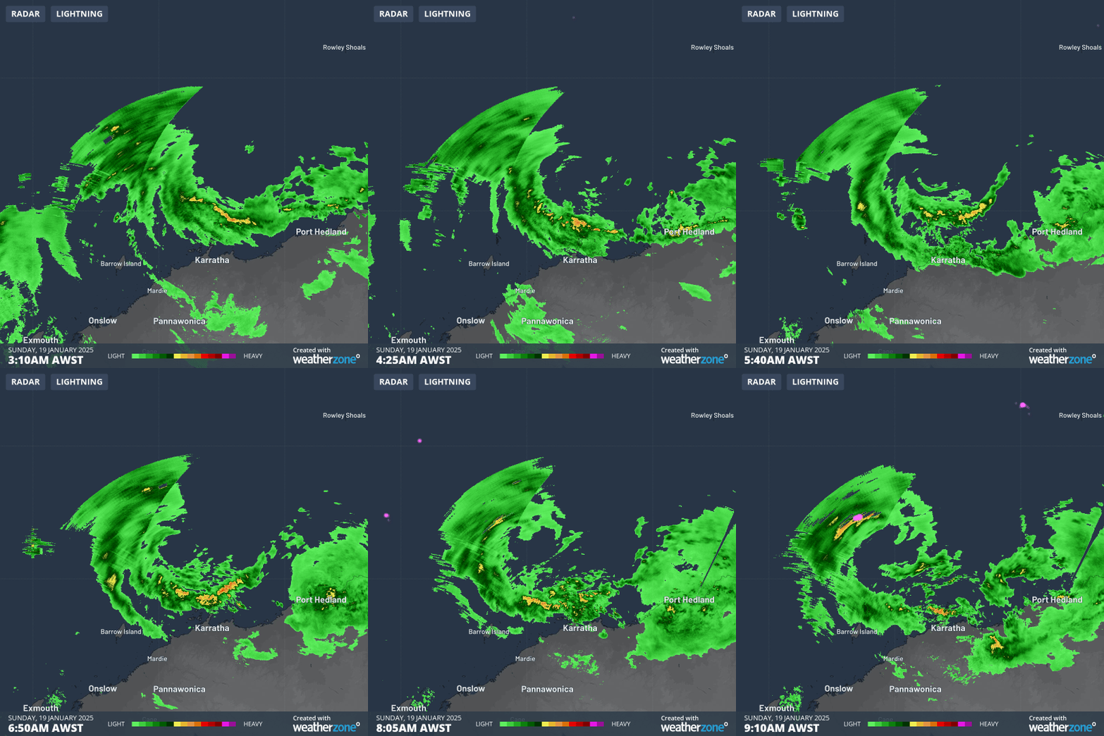
As of 9am WST Sunday, Tropical Cyclone Sean is spinning up 150km north-northwest of Karratha, heading west-southwest at 13km/h, roughly parallel to the Pilbara coast. The rotation of the system, as well as the developing rainbands, can be clearly seen from the Karratha radar this morning.

Image: Observed radar and lightning showing Tropical Cyclone Sean spinning up on Sunday morning off the Pilbara coast. Source: Weatherzone
By 9am WST Sunday, winds at Legendre Island had reached sustained speeds of 85km/h, gusting to 107km/h, the island's strongest gust in three years, indicative of a cyclone that is already a high-end category 1. Meanwhile, gale force winds started on the mainland at Karratha at 8:30am, with sustained winds of 65km/h, gusting above 85km/h. These winds will likely continue to increase during Sunday, before easing as the system moves further down the coast.

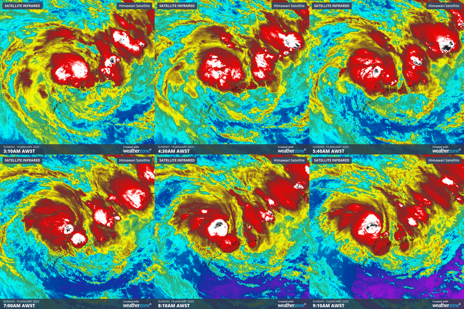
Image: Enhanced infrared satellite showing the development of Tropical Cyclone Sean. Areas in white and black show intense convection and thunderstorms. Source: Weatherzone
Tropical Cyclone Sean will likely intensify further as it moves parallel to the coast. It is expected to strengthen into a Category 2 system by Sunday evening, and a Category 3 severe tropical cyclone on Monday.
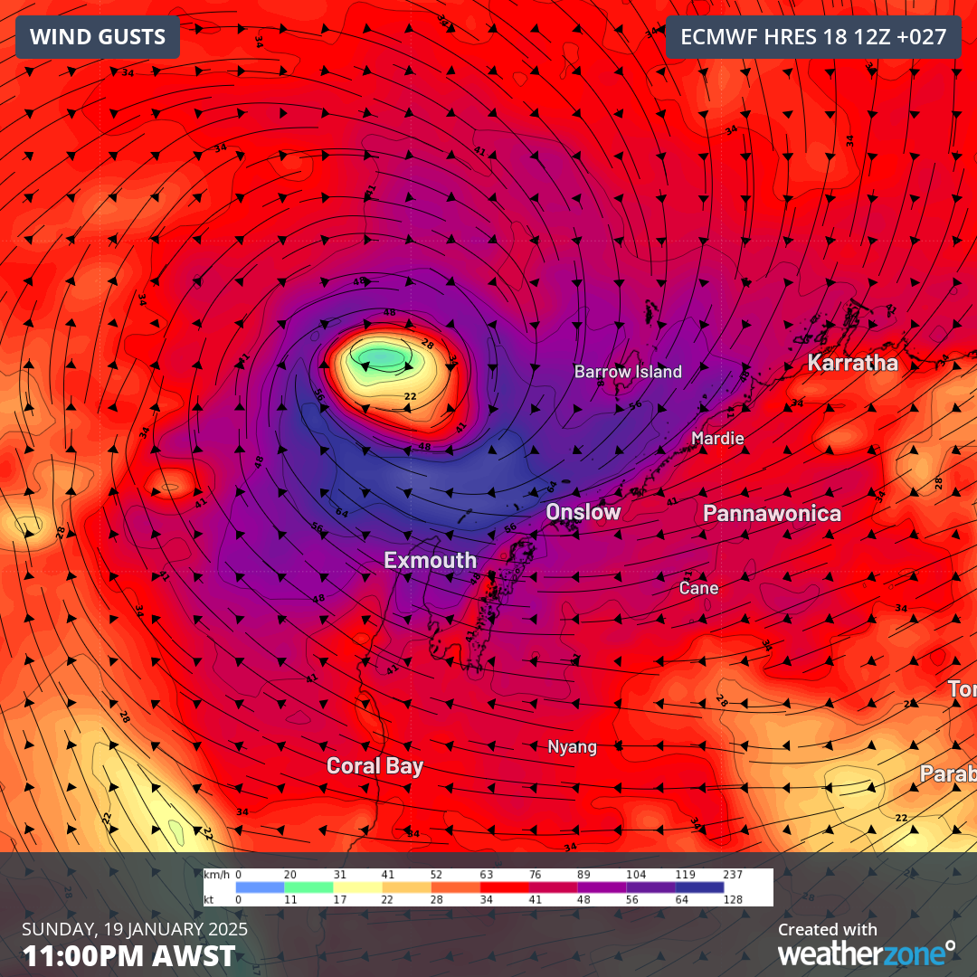
Damaging to destructive winds are expected to impact southern parts of the Pilbara coast, including Onslow and Exmouth during Sunday and Monday, easing on Tuesday morning. Barrow Island, the world-record holder for highest wind gust, will likely experience category 2 strength winds, with gusts up to 160km/h possible.

Image: Forecast wind gusts on Sunday evening from ECMWF. Source: Weatherzone
Rainfall is likely to arrive in a fairly short amount of time, given the system’s movement along the coast, but will also be bolstered by the monsoon arriving in the back edge of the cyclone. In the 24 hours to 9am Sunday, some of the standout rainfall totals were:
- 123mm at Pardoo, its wettest day in 4 years
- 95mm at Lombadina, its wettest day in 2 years
- 81mm over Port Hedland, its wettest day in 3 years
- 35mm at Onslow, its wettest January day in 16 years
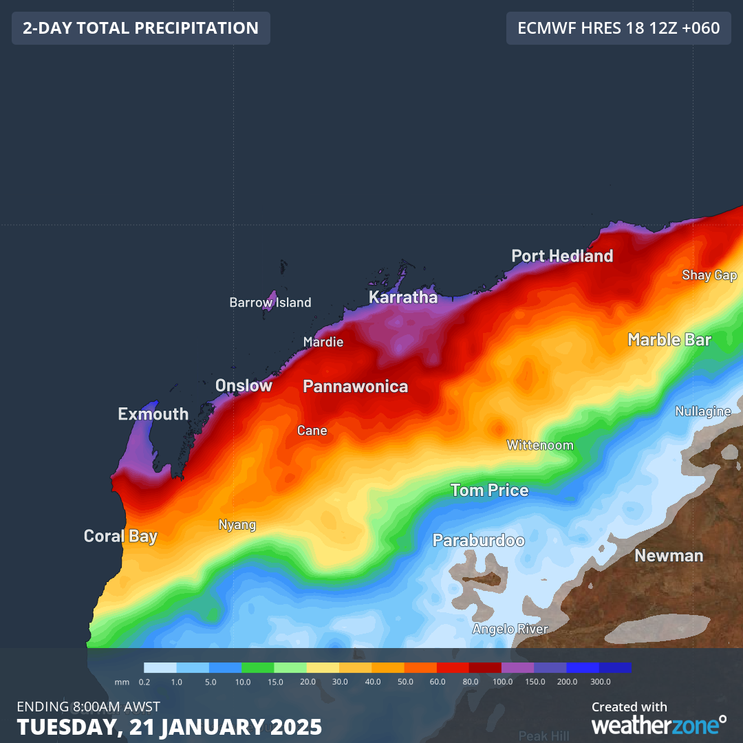
Overall, the system is likely to produce a widespread 100-150mm along the Pilbara coast over the next 36-48 hours, with isolated falls of 250-300mm possible.

Image: Forecast accumulated rainfall to Tuesday morning from ECMWF. Source: Weatherzone
A storm tide is also expected between Port Hedland and Exmouth during high tide on Sunday and Monday. This increased water level, along with significant wave heights up to 4 metres, may produce minor flooding along the foreshore.
Western Australians in the path of this tropical cyclone are advised to keep a close eye on the warnings issued by the BoM and the WA Government over the next few days, as well as the Weatherzone news feed for further developments.


 English (US) ·