ARTICLE AD BOX
- Weather
- Radar & Charts
- News
- Help
Log into Weatherzone
Don't have an account?
Personalise your weather experience and unlock powerful new features.
Anthony Sharwood
02 Dec 2024, 11:15 PM UTC
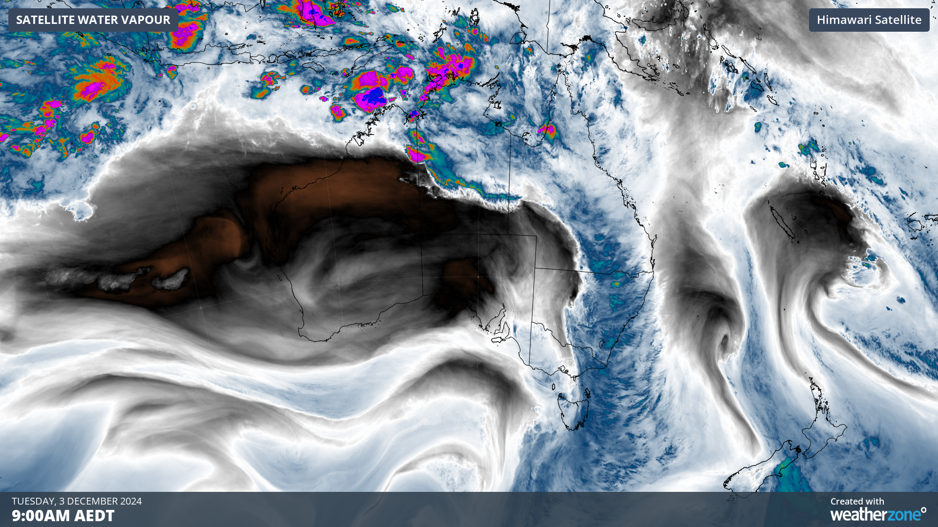
An enormous cloudband can be clearly seen on satellite imagery this Tuesday morning stretching from Australia's northern tip to waters well south of Tasmania.
The cloudband swept across inland parts of the eastern states overnight, and continues its progress out into the Tasman and Coral Seas, delivering handy falls of rain as it passes through.

Image: Atmospheric water vapour (the blue areas) associated with the cloudband at 9am (AEDT) on Tuesday, December 3, 2024.
Some of the noteworthy rainfall totals to 9am Tuesday included:
- Falls exceeding 50mm at three locations in Victoria's North East, with lighter falls in each of the other eight forecast districts, although Melbourne received less than a millimetre.
- Widespread light to moderate totals across western and central NSW, with a statewide highest reading of 29mm at Condobolin, the hometown of Aussie singer Shannon Noll.
- Significant rain in many parts of Queensland, including 16.2mm at Birdsville 13mm at Thargomindah in Queensland's far southwest. While those totals aren't huge, they were the heaviest falls since July in both towns – and a strong indication of the high level of atmospheric moisture over parts of inland Australia early this week.
- Numerous falls in the range of 10 to 25mm in northern Tasmania, including 25mm at the state's third-largest city Devonport, where the monthly average rainfall for December has already been exceeded after heavy falls on the first day of the month and two days of follow-up rainfall.
- Handy falls were also recorded in parts of South Australia, including 8mm in Adelaide where any December rain is good rain after the total spring 2024 rainfall of just 67.6mm, which was barely half of the seasonal average.
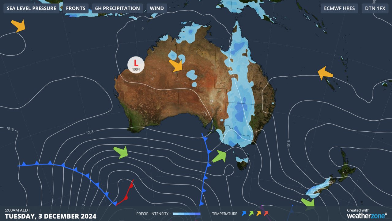
As Weatherzone’s early morning synoptic chart for Tuesday shows, the overnight rain fell along a trough of low pressure wedged between areas of high pressure to the east and west.

Image: Synoptic chart for Australia at 5am (AEDT) on Tuesday, December 3, 2024.
Rain and showers are expected to clear over much of eastern Australia over the next day or two, although onshore winds will generate persistent showers over most of Queensland's coastline.
Inland storms also remain a possibility throughout most of the areas mentioned, with the likelihood of more widespread storm and shower activity increasing into the weekend.
Note to media: You are welcome to republish text from the above news article as direct quotes from Weatherzone. When doing so, please reference
www.weatherzone.com.au in the credit.


 English (US) ·