ARTICLE AD BOX
Storms make other storms: that's the gist of this story in four words, and here's how that effect has played out in Australia in recent days.
Beginning last weekend, a stormy outbreak occurred over central Queensland due to the classic summer recipe for atmospheric instability consisting of seasonal heat and a broad trough of low pressure.
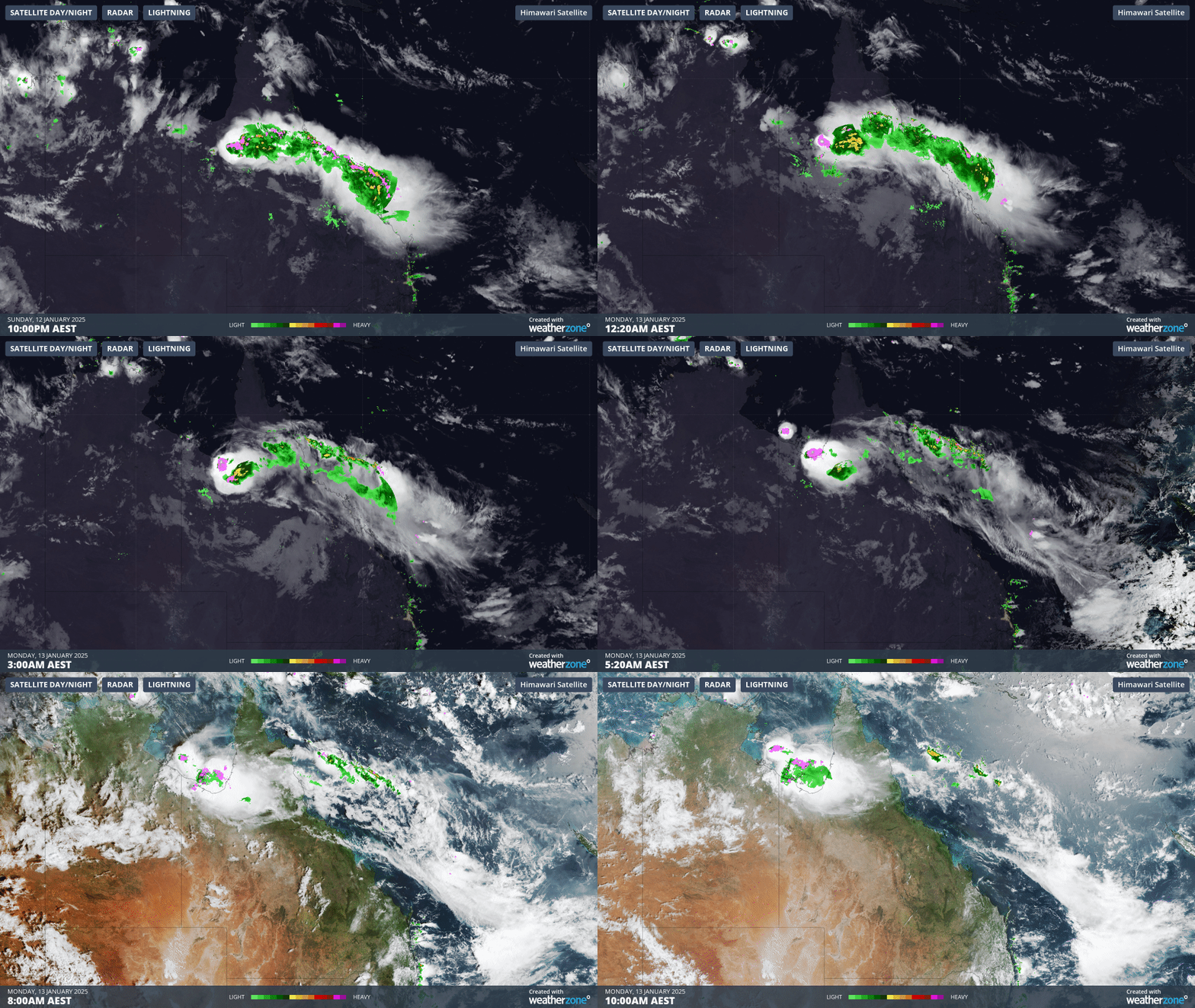
As you can see on the video loop below extending from Sunday into Tuesday morning, one storm after another broke out over central Queensland, then coastal regions of north Queensland, then the Queensland Gulf Country, then the Gulf of Carpentaria itself.
Thunderstorms over central QLD on Sunday trigger a "domino effect" that extends to the Timor Sea by Tuesday. pic.twitter.com/9u6zqJ3HJd
— Andrew Miskelly (@andrewmiskelly) January 13, 2025It's as though the storms seemed to spawn other storms in an atmospheric "domino effect", as Weatherzone’s Andrew Miskelly colourfully phrased it.
But is that really a thing? Can one storm help create another? They can indeed, as Weatherzone meteorologist Ben Domensino explains:
"The outflow from one storm triggers the next storm and so on. You can see that in the animation if you look carefully."

Image: Storms creating storms creating storms over northern parts of Queensland early on the morning of Monday, January 13, 2025.
- Storm outflow is the cool air that flows outwards from a thunderstorm in a downdraft. The cooler air can lead to new storm forming by creating a gust front that lifts air, allowing new updrafts to form, which in turn lead to more storms.
- This effect is clearly happening in the video loop above, which shows a series of storms pushing northwards even in the dead of night.
- We tend to think of weather being caused by either localised or broad-scale factors, when in reality, it is almost always a combination of both. This week's Queensland storm outbreak is a good reminder of that.
Meanwhile there's a strong likelihood of storms across a wide area of eastern Australia this Wednesday as a low pressure system and associated trough crosses the continent.
Severe thunderstorm warnings are already in place for some forecast districts, with many more such warnings likely to be issued, so please keep checking the Weatherzone warnings page for the latest info.


 English (US) ·