ARTICLE AD BOX
Parts of southeast Queensland and the eastern third of New South Wales were alive with storms on Wednesday afternoon and evening, with some areas copping a drenching while others didn’t see a drop.
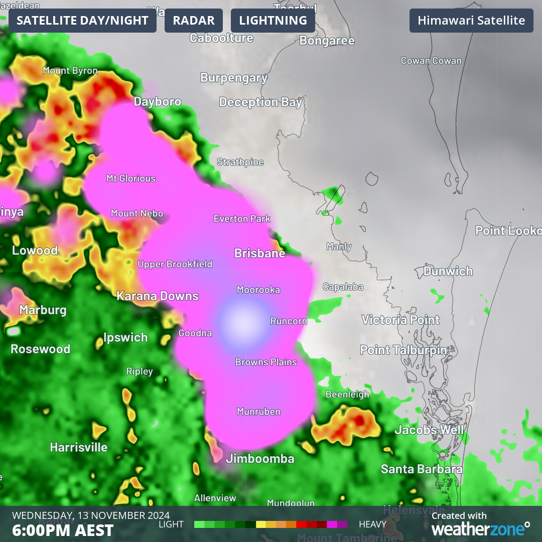
Late in the afternoon, a line of severe thunderstorms marched towards Brisbane from the west, dumping around 20mm in under an hour in places like Dalby and Oakey on the Darling Downs, and in Amberley, about 50 km SW of the CBD.
As the storms arrived in Brisbane around 6pm, the city received 17.8mm of rain inside just 20 minutes with heavy rain still falling. A wind gust of 80 km/h was reported at Archerfield, about 15km south of the CBD.
Back at my hotel in Brisbane watching and listening to the most amazing lightning storm! pic.twitter.com/AqN9ukzvrd
— Siobhan (@SiobhanLeachman) November 13, 2024Severe gusts accompanied many of the storms, including a gust of 91 km/h at Warwick on the Darling Downs at 2:30 pm.

Earlier on Wednesday afternoon, storms lashed areas both north and south of Sydney while the metropolitan area missed out on the most intense weather with most suburbs remaining bone dry.
- Moss Vale, on the Southern Highlands about 90 minutes southwest of the Sydney CBD, saw 34mm in back-to-back storms.
- Nowra, on the Illawarra coast just south of Wollongong, received 21mm, most of it in less than 20 minutes just before 3pm.
- Meanwhile Bellambi, the main coastal weather station for Wollongong, saw just 0.2mm.
Further south on the NSW coast, Bega, Merimbula and Ulladulla all received 10mm or more in a relatively short period of time.
Further inland, the rural locality of Jerangle (north of Cooma and not too far from Canberra) received 24mm in just half an hour around midday.
Canberra itself completely missed out, continuing its frustratingly dry November with not a drop of rain yet recorded.
Wednesday's storms have been caused by humid air feeding into a broad low pressure trough, and similar conditions will persist in coming days with the likelihood of more widespread storm activity across eastern Australia.


 English (US) ·